The main content of this page starts here

Land-use monitoring (based on remote sensing) Monitoring of habitat diversity

Land-use monitoring (based on remote sensing)

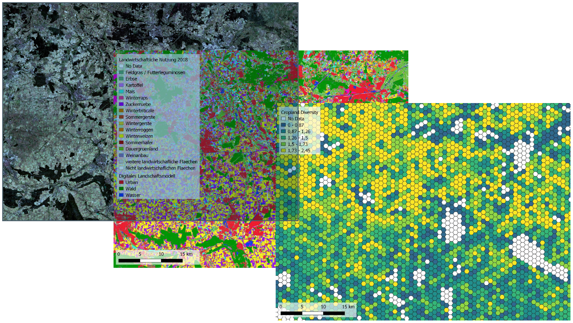
The occurrence and diversity of insects and other organism groups in agricultural landscapes is significantly influenced by the use and intensity of agricultural land. Monitoring biodiversity in agricultural landscapes therefore requires - in addition to knowledge about the distribution and diversity of organism groups - a representative database on land use and habitat diversity in the agricultural landscape.

Satellite remote sensing is capable of recurrent and area-wide coverage of the land surface and from this to generate information on land use and its change. This includes information on the status quo, on short-term changes as well as on trends in land use.

The aim of the module "Land use monitoring - based on remote sensing" is to create a data basis as well as a geodata infrastructure that will enable regular and long-term documentation of the status and changes in the agricultural landscape for trend monitoring on the basis of satellite images and other geodata. For this purpose, a number of attributes of land use and land use intensity are first recorded in the first phase. From these, satellite-based biodiversity indicators will be generated in the second phase, which will provide a basis for the future evaluation of measures to conserve and improve biodiversity in agricultural landscapes for Germany.

Going from a Sentinel-2 scene towards the sub-indicator "crop diversity"

Left: Sentinel-2 satellite image of a region south of Braunschweig, Lower Saxony; center: mapping of main crop types based on Copernicus satellite data; right: exemplary representation of "crop diversity" for 1 km² hexagons. The figure uses an example to illustrate the process from the acquisition of a satellite image to the calculation and presentation of a (partial) indicator of habitat diversity. Crop diversity is a measure of how many different crop species occur in which distribution within a landscape section (here: hexagons). The higher the value, the higher the cropping diversity in the hexagon cell. High crop diversity generally has a positive effect on habitat diversity and thus biodiversity in the agricultural landscape.
Data sources: Sentinel-2 (ESA); ATKIS DLM (geospatial base data: © GeoBasis-DE / BKG 2018).

Contact

Stefan Erasmi
Thünen-Institute for Farm Economics
stefan.erasmi(at)thuenen(dot)de

Marcel Schwieder
Thünen-Institute for Farm Economics
marcel.schwieder(at)thuenen(dot)de

Markus Möller
Julius Kühn-Institute for Crop and Soil Science
markus.moeller(at)julius-kuehn(dot)de

Heike Geringhausen
Julius Kühn-Institute for Crop and Soil Science
heike.geringhausen(at)julius-kuehn(dot)de