The main content of this page starts here
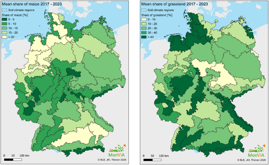
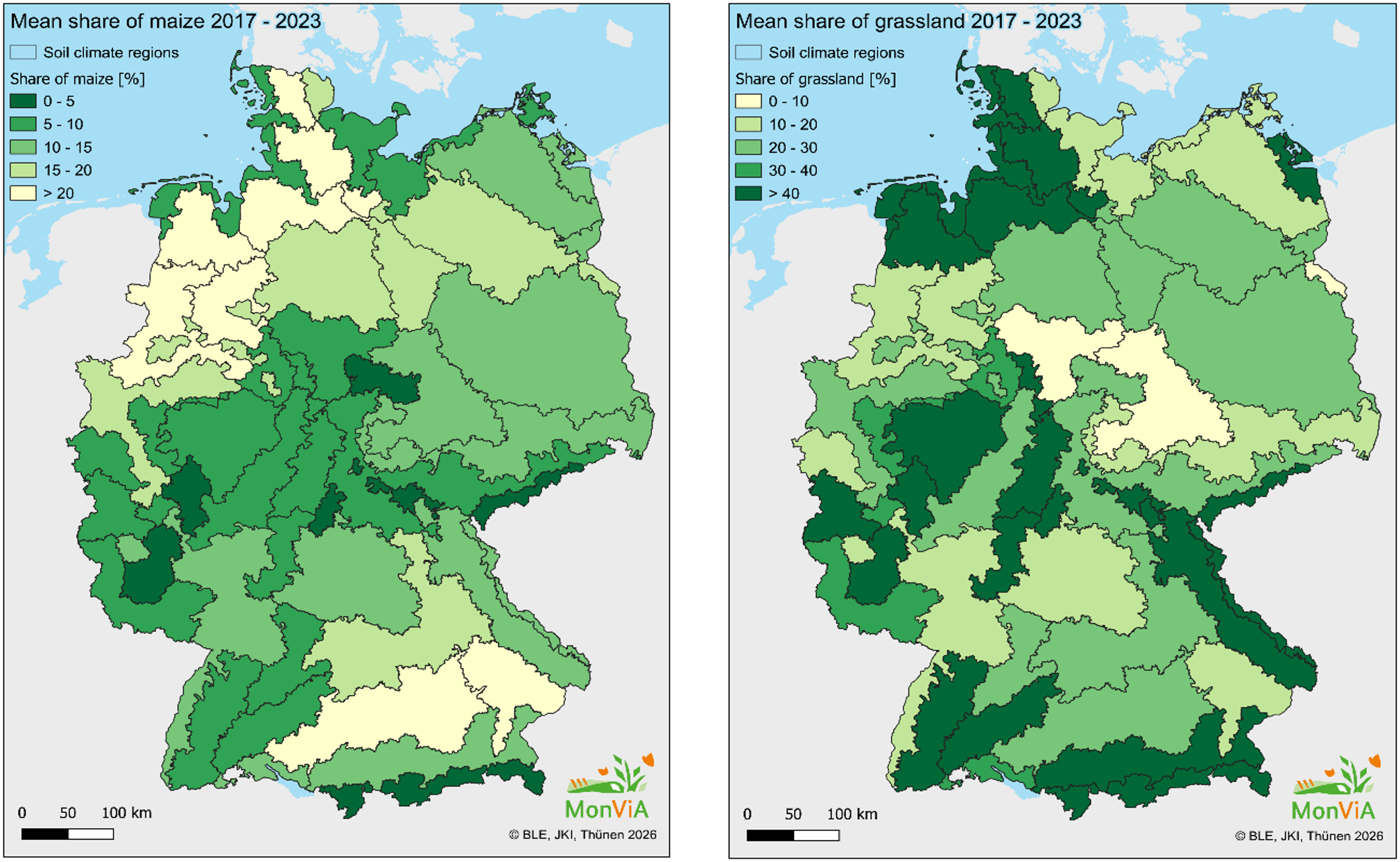
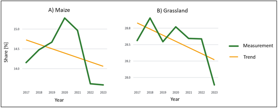
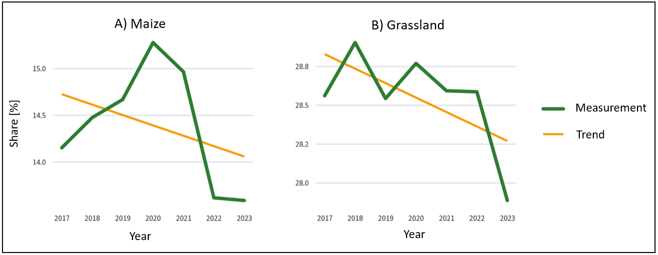
The indicator describes the occurrence of the main crop types and selected ecologically relevant land uses. For some land use classes – for example, permanent grassland or fallow land – the following generally applies: a higher proportion of these areas is associated with higher ecological value. For other classes – such as maize or winter cereals – the relationship between area share and ecological value is negative for most of the observed range of values. The calculation covers selected land use classes whose importance for biodiversity is well documented. The proportion of a land use class is calculated in relation to the total agricultural land (pTALi), utilised agricultural area (pUAAi), or open landscape (pOLi). The calculation of the indicator is based on a 7-year time series (currently 2017–2023) with national spatial coverage.
Last updated: 2026 (Based on Indicator Sheet v2024_2 )